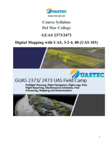
GUAS 2373/2374 - 103 UAS Field Camp

Course Description
This course, developed by the Unmanned Aircraft Systems Technology Education Consortium (UASTEC) at Del Mar College, covers planning and executing sUAS flight plans. "This course applies all of the theory and skills taught in the first two GUAS courses (101 and 102) through hands-on field-based experience." Those courses are available to view separately. The following are some of the learning outcomes for this course:
- Demonstrate and obtain knowledge of UAS guidance, navigation and control. (multiple softwares for manual and autonomous flight).
- Perform approved preflight planning and mission controls.
- Demonstrate understanding of basic UAS elements.
- Demonstrate a basic knowledge of UAS aerodynamics and flight dynamics.
- Describe the basic principles of UAS operation requirements and develop suitable mission flight planning as per ConOps (Concepts of Operations).
- Assess commercially available UAS and its suitability for the job.
- Design a UAS-based aerial imagery operation.
- Design a UAS-based preflight mission.
- Demonstrate the use of situational awareness assess risks surrounding operating a UAS and propose mitigation for such risks.
- Design and demonstrate using RPIC Crew Resource Management Principles and Due Diligence assess flight mission pre and post.
- Perform approved preflight planning and mission controls.
- Be able to design UAS survey missions to collect appropriate spatial and spectral resolution data.
- Be able to process UAS data to generate geospatial data products such as orthomosaic images, 3D point cloud data, and Digital Surface Model (DSM).
- Be able to analyze the quality of UAS-derived geospatial data products and produce a quality report.
- Be able to synthesize UAS-derived geospatial data products in a GIS to perform 2D and 3D mapping of natural and built environments.
Course Contents
Course materials are provided in .zip and .imscc attachments. The guas-2473-slash-uas-103-slash-aacc-ate-nsf-export.imscc attachment includes numerous folders and files for the entire Canvas course.
The .zip attachment includes the following course materials: a syllabus, three lecture modules, three module support documents, and a list of additional suggested support documents. Most of these materials are available in .pdf and .docx or .ppxt formats.
The 7-page syllabus includes a course description, 22 learning outcomes and course competencies, software and technology requirements, methods of evaluation, and more.
The three lecture modules cover the elements of photogrammetry, structure from motion, and UAS mapping fundamentals. Each module includes a list of objectives and a number of images and diagrams.
The following three support documents are included: URISA: Lessons Learned Developing a UAS Program for Local Government; Flight Planning, Preparation & Operation; and Zephyr UAS Flight Simulator LMS. These documents provides links to related websites, videos, webinars, and other resources.
For orientation purposes the syllabus is included as a separate attachment and offers a sample of the type of material included in this course.
Below is a list of the folders contained within the attachments. The size of each folder and number of files is included in parenthesis.
guas-2473-slash-uas-103-slash-aacc-ate-nsf-export.imscc (964 files 1.86 GB)
GUAS2473_UAS103 (33 files, 72.5 MB)
- GUAS 2373/2473 UAS Field Camp Syllabus (GUAS2373_2473_UAS103_Syllabus_Modules_GUAS2373_2473_UAS103_Course Syllabus.docx 1 MB)
- GUAS 2373/2473 UAS Field Camp Syllabus (GUAS2373_2473_UAS103_Syllabus_Modules_GUAS2373_2473_UAS103_Course Syllabus.pdf 335 KB)
- GUAS2473_UAS103_Lecture_Modules
- GUAS2473_UAS103_Mod_Lec_Support_Docs
- URISA: Lessons Learned Developing a UAS Program for Local Government (GUAS2372_Doc_URISAwebinar_UAS_Local_Govt.pdf 347 KB)
- Flight Planning, Preparation & Operation (GUAS2473_Doc_FlightPlaning_Preparation_Operation.docx 2.3 MB)
- Flight Planning, Preparation & Operation (GUAS2473_Doc_FlightPlaning_Preparation_Operation.pdf 1.1 MB)
- Zephyr UAS Flight Simulator LMS (GUAS2473_Doc_Pix4D_FlightSimulators.docx 391 KB)
- Zephyr UAS Flight Simulator LMS (GUAS2473_Doc_Pix4D_FlightSimulators.pdf 540 KB)
- URISA: Lessons Learned Developing a UAS Program for Local Government (GUAS2473_Doc_URISAwebinar_UAS_Local_Govt.docx 2.2 MB)
- URISA: Lessons Learned Developing a UAS Program for Local Government (Suggested Lecture Module Support Resources Bibliography 45 KB)
- Module 1 Elements of Photogrammetry (7) (GUAS2473_UAS103_Module 1_ElementsPhotogrametry.pdf 4.9 MB)
- Module 1 Elements of Photogrammetry (7) (GUAS2473_UAS103_Module 1_ElementsPhotogrametry.pptx 9.4 MB)
- Module 2 Structure from Motion (SfM) (8) (GUAS2473_UAS103_Module 2_SfM.pdf 3.8 MB)
- Module 2 Structure from Motion (SfM) (8) (GUAS2473_UAS103_Module 2_SfM.pptx 17 MB)
- Module 3 UAS Mapping Fundamentals (GUAS2473_UAS103_Module 3_MappingFundementals.pdf 3.8 MB)
- Module 3 UAS Mapping Fundamentals (GUAS2473_UAS103_Module 3_MappingFundementals.pptx 17.6 MB)
- GUAS2473_UAS103_Mod_Lec_Support_Docs
- GUAS2473_UAS103_Screenshots
- (GUAS2473_UAS103_Unit_1_ElementsPhotogrametry7.JPG 172 KB)
- (GUAS2473_UAS103_Unit_2_SfM.JPG 172 KB)
- (GUAS2473_UAS103_Unit_3_MappingFundementals.JPG 172 KB)
- (HowTomakeMapsDrones.JPG 136 KB)
- (UNAVCO.JPG 14 KB)
- (GUAS2473_UAS103.JPG 101 KB)
About this Resource

Comments