Urban Sprawl and Sediment Loading in the Chesapeake Bay

Exercise Description:
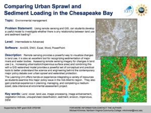
This exercise, created by the Integrated Geospatial Education and Technology Training Project (iGETT) asks students to develop a model to examine the relationship between land use and sediment loading. Data from the Chesapeake Bay region will be utilized. Remote sensing imagery will be analyzed alongside a GIS watershed model; the lesson will not only provide practice using ArcGIS and ENVI, but will also help students understand the possible correlations between urban sprawl and watershed protection.
By completing this exercise, students will learn how to preprocess imagery data for use in imagery analysis and GIS software, process raster and vector data for use in GIS, apply the scientific method to develop hypotheses about the real world, implement a geodatabase (apply the ArcGIS object-oriented database) to manage diverse data types, apply basic concepts of map algebra in an extended raster-based analysis, and apply principles of map design and data considerations.
This exercise takes about twelve to sixteen hours to complete and is intended for small groups of three to four students that have basic knowledge of remote sensing and a familiarity with ENVI software. A learning unit summary, instructor and student guides, supporting documents and data files are included.
Exercise Contents:
The attached files associated with this exercise are .doc and a variety of geospatial data file types.
Below is a list of the files contained in the .zip attachment, with the file name and size provided in parenthesis.
- LU_Krim (50 files, 1.58 GB)
- Curriculum Support Document (Krimmer_CS.pdf, 40 KB)
- Instructor Guide (Krimmer_IG_Final.pdf, 177 KB)
- Student Handout (Krimmer_SH_Final.pdf, 4.6 MB)
- Comparing Urban Sprawl and Sediment Loading in the Chesapeake Bay (Krimmer_Thumbnail.pdf, 205 KB)
- mkrimmer_Data1.rar (252.6 MB)
- DEMs
- NED_SRTM_1ArcSec.zip (36.3 MB)
- NED_SRTM_ArcSecA.zip (43.1 MB)
- LSAT_1987
- Revised Landsat-5 TM Radiometric Calibration Procedures and Post-calibration Dynamic Ranges (LandSat_ETM_Calibration_2003.pdf 326 KB)
- METADATA FILE.txt (363 bytes)
- p015r33_5t870516_nn1.tif.gz (25.9 MB)
- p015r33_5t870516_nn2.tif.gz (22.8 MB)
- p015r33_5t870516_nn3.tif.gz (26.4 MB)
- p015r33_5t870516_nn4.tif.gz (31.8 MB)
- p015r33_5t870516_nn5.tif.gz (32.9 MB)
- p015r33_5t870516_nn7.tif.gz (27.8 MB)
- Supporting_Material
- Sediment Sources and Depositional Environment sed_source-map.pdf, 4.9 MB)
- Bay Sediments Fact Sheet (SedFactsheet.pdf, 307 KB)
- The Impact of Sediment on the Chesapeake Bay and its Watershed (SedimentBay605.pdf 595 KB)
- An Introduction to Sediments: Sediment and its Relationship to Chesapeake Bay Water Clarity (SedShedReportFINAL.pdf, 339 KB)
- DEMs
- mkrimmer_Data2.rar (187.5 MB)
- Hydro_Data
- The National Hydrography Dataset (NHD_QuickStart_Sept_05.pdf, 124 KB)
- NHD127506.zip (13.9 MB)
- NHDinGEO Tasks for ArcGIS 8.3 and Higher (NHDinGEO_Tasks_Sept_06.pdf, 136 KB)
- LandCover
- 81454793.zip (526 KB)
- LSAT_2001
- metadata.txt (6 KB)
- p015r033_7t20011005_z18_nn10.tif.gz (24.5 MB)
- p015r033_7t20011005_z18_nn20.tif.gz (25.3 MB)
- p015r033_7t20011005_z18_nn30.tif.gz (28.9 MB)
- p015r033_7t20011005_z18_nn40.tif.gz (32.5 MB)
- p015r033_7t20011005_z18_nn50.tif.gz (32.7 MB)
- p015r033_7t20011005_z18_nn70.tif.gz (30.4 MB)
- Hydro_Data
- mkrimmer_Data3.rar (341 MB)
- gsmsoil_us.zip (344.9 MB)
About this Resource

Comments