Quantifying Changes in the Land Over Time

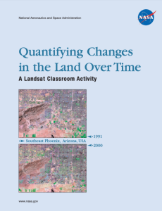
This 36-page landsat activity was published by the National Aeronautics and Space Administration and is intended "to enable students to analyze land cover change." This activity will help students "... grasp the extent, significance, and consequences of land cover change; and to introduce them to the perspective of space-based observations." After completing the activity, students will be able to:
- identify some major land cover types in a land remote sensing image,
- make maps of land cover at a regional (landscape) scale,
- quantify land cover change over time,
- predict ways and directions that an urban area might grow,
- and more.
The following sections are included in the activity: Purpose, Overview, Grade Level, Time Required, Goals for Student Learning, Objectives, National Standards, Activity Steps at a Glance, Student Prerequisites, Materials and Tools, Teacher Preparation, Classroom Management, Student Learning Assessment, Background on Land Cover Change, and more.
About this Resource
Resource Type
Audience
Education Level
Language
Subject
GEM Subject
Relation
Associated Files
Archived
Rights
Access Rights
Comments