Browse Resources
Information and Security Technologies -- Geospatial technologies
Resources |
|---|
This video, provided by Virginia Geospatial Extension, is part of a series of 28 tutorial videos on remote sensing with ArcGIS Pro. This video is the last of three tutorials that cover adding data to a map project. This tutorial briefly describes the differences between raster and vector data files....
This tutorial, provided by Virginia Geospatial Extension, is part of a series of 30 videos that cover remotely sensed data in ArcMap 10.x versions. This tutorial demonstrates adding data to an ArcMap document. This video runs 00:49 seconds in length. The other videos in the series are available to...
This video, provided by Virginia Geospatial Extension, is part of a series of 16 tutorial videos on using Lidar with ArcGIS Desktop. This tutorial demonstrates how to add files to an existing LAS-formatted Lidar datasets for use in ArcGIS Desktop. This video runs 04:29 minutes in length. The other...
This video, provided by Virginia Geospatial Extension, is part of a series of 28 tutorial videos on remote sensing with ArcGIS Pro. This video is the second of three tutorials that cover adding data to a map project. This tutorial demonstrates how to add shapefiles to a geodatabase using ArcGIS Pro...
This video, provided by Virginia Geospatial Extension, is part of a series of 22 tutorial videos on working with Lidar using ArcGIS Pro. This tutorial demonstrates adding tiles to the Mesa County LAS dataset, updating statistics for a LAS dataset, and removing tiles from a LAS dataset. This video...
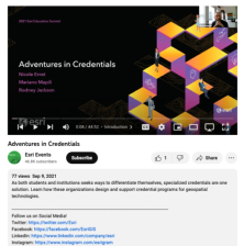
This video, from the 2021 Esri Education Summit, provides two presentations on credential programs for geospatial technologies. In the first presentation, Nicole Ernst from GeoTech discusses the Geospatial Science and Technology Educator Certification (GSTEdC) program. Ernst highlights the program's...
This one page PDF, from the GeoTech Center, provides essential resources for starting a new geospatial academic program.
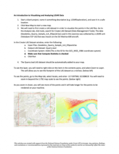
In this 4-page activity, provided by the Unmanned Aircraft System operations Technician Education Program (UASTEP), students are introduced to some of the properties (i.e. return value, point count) of LiDAR data gathered by a sensor mounted on a drone or unmanned aircraft system. In addition,...
Learning Unit Description:
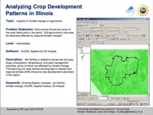
The Integrated Geospatial Education and Technology Training Project (iGETT) presents a series of Learning Units (LU) designed to incorporate federal land remote sensing data into Geographic Information System (GIS) instruction. The Analyzing Crop Development Patterns in...
These presentation slides, provided by the GeoTech Consortium of Western New York (GTCWNY), are from the Professional Development Workshop on Integrating Geospatial Technology into the HS Classroom hosted by GTCWNY. The workshop focused on Geographic Information Systems (GIS) education and ways to...
|
| ← PreviousNext → |


