Concept Module - Color

This module is provided by GeoTech Center, and introduces the art and science of color and its role in geospatial analysis visualizations. This learning module will also discuss how to select appropriate colors for different classifications of data. Module contents include one overview document, a recorded PowerPoint presentation, a PowerPoint file of the slides from the presentation, and a quiz that reviews the module.
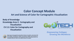
The Concept Module is a recorded PowerPoint presentation that provides an introduction to the module by educator Ann Johnson, and reviews the use of color in visualizations of geospatial analysis emphasizing that both art and science are needed when choosing appropriate colors. Topics include the science of visualization, color dimensionality, true primary colors, and color conventions in data visualization. The video recording runs 15:12 minutes in length.
The quiz contains 10 questions that review the material covered in the module presentation. The quiz includes multiple choice and true/false questions.
Below is a list of files included in the .zip attachment. The size of each file is included in parenthesis.
Concept Module - Color.zip (250.7 MB, 4 items)
- Color Concept Module Overview (Color Concept Module.docx 12 KB)
- Concept Module Color Video (Concept Module Color edited 11-17-19 V3.mp4 218.8 MB)
- Concept Module Color PowerPoint Presentation (Concept Module Color edited 11-17-19 V3.pptx 31.7 MB)
- Quiz Review (Quiz for Color Concept Module for 11-11-19 V3.pptx 141 KB)
About this Resource

Comments