Creating a Python Script Within a Notebook (Module 9 of 9)

This resource, provided by the GeoTech Center, is the ninth and final online module in the Python and Geospatial Mapping course. The course is designed for experienced users of Global Information Systems (GIS) platforms who are new to programming, with the goal of teaching them how to use Python to automate processes through the construction of short scripts in ArcGIS Pro.
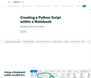
This module focuses on coding in Jupyter Notebook, which can be added to ArcGIS Pro to manage Python scripts within the program that are immediately viewable on the map. The module covers the installation of the notebook, buffering in the notebook, viewing the notebook alongside the map, and navigating the notebook window. Additionally, a variety of example scripts and functions are demonstrated within the notebook, including coding with GIS Python commands such as ListFields and ListFeatureClasses, working with the mp Module, displaying the contents of a feature class file, geocoding, and more.
Other modules in the course are available to view separately.
Comments