Browse Resources
Audio/Visual -- Movie/Animation
Resources | |
|---|---|
In this activity, presented by the Lane Community College's MAPS GIS Program, students will learn important geospatial concepts. These concepts include: scale, data layers, query, buffer and measurement. This tutorial is a building block for other GIS based lessons featured on the website. Visitors...
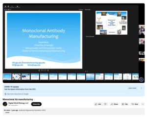
This video, provided by Digital World Biology, is from the 2022 Antibody Engineering Hackathon, an event where teams collaborated to develop Course-based Undergraduate Research projects (CURES) for students studying biotechnology. In this presentation, David Blum, directer of the Bioexpression and...
This video, from the Laser and Fiber Optics Regional Center, is the fourth of eight lectures in the Introduction to Photonics Video Series for Technologists. This video discusses properties of light. After viewing this lecture, viewers will be able to:
understand the nature of optical materials...
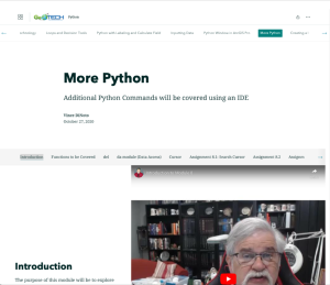
This resource, provided by the GeoTech Center, is the eighth of nine online modules in the Python and Geospatial Mapping course. The course is designed for experienced users of Global Information Systems (GIS) platforms who are new to programming, with the goal of teaching them how to use Python to...
This video, provided by the GeoTech Center, is from the eighth module of the Python and Geospatial Mapping course, titled More Python. The course is designed for experienced users of Global Information Systems (GIS) platforms who are new to programming, with the goal of teaching them how to use...
This video assignment, provided by the GeoTech Center, is the first assignment from module eight of the Python and Geospatial Mapping course, titled More Python. The course is designed for experienced users of Global Information Systems (GIS) platforms who are new to programming, with the goal of...
This video assignment, provided by the GeoTech Center, is the second assignment from module eight of the Python and Geospatial Mapping course, titled More Python. The course is designed for experienced users of Global Information Systems (GIS) platforms who are new to programming, with the goal of...
This video assignment, provided by the GeoTech Center, is the third assignment from module eight of the Python and Geospatial Mapping course, titled More Python. The course is designed for experienced users of Global Information Systems (GIS) platforms who are new to programming, with the goal of...
This video assignment, provided by the GeoTech Center, is the fourth assignment from module eight of the Python and Geospatial Mapping course, titled More Python. The course is designed for experienced users of Global Information Systems (GIS) platforms who are new to programming, with the goal of...
This video assignment, provided by the GeoTech Center, is the fifth assignment from module eight of the Python and Geospatial Mapping course, titled More Python. The course is designed for experienced users of Global Information Systems (GIS) platforms who are new to programming, with the goal of...
| |
| ← Previous | Next → |


