Browse Resources
Instructional Material -- Tutorial
Resources |
|---|
 This tutorial, provided by Virginia Geospatial Extension, is part of a series of 30 videos that cover remotely sensed data in ArcMap 10.x versions. This video covers displaying Landsat imagery in ArcMap, Setting processing workplaces, and the Image Analysis Window. This video runs 02:53 minutes in...
 This tutorial, provided by Virginia Geospatial Extension, is part of a series of 30 videos that cover remotely sensed data in ArcMap 10.x versions. This video demonstrates modifying symbology for vector and raster features in ArcMap. This video runs 01:48 minutes in length. The other videos in the...
 This video, provided by Virginia Geospatial Extension, is part of a series of 28 tutorial videos on remote sensing with ArcGIS Pro. This tutorial demonstrates how to display raster data in ArcGIS Pro version 2.2. This video runs 05:12 minutes in length. The other videos in the series are available...
 This video, provided by Virginia Geospatial Extension, is part of a series of 28 tutorial videos on remote sensing with ArcGIS Pro. This tutorial "provide[s] step by step instructions for downloading Landsat 8 imagery via USGS's EarthExplorer website." This video runs 10:45 minutes in length. The...
 This tutorial, provided by Virginia Geospatial Extension, is part of a series of 30 videos that cover remotely sensed data in ArcMap 10.x versions. This video demonstrates viewing and downloading Landsat imagery using Earth Explorer. The video runs 01:55 minutes in length. The other videos in the...
 This tutorial, provided by Virginia Geospatial Extension, is part of a series of 30 videos that cover remotely sensed data in ArcMap 10.x versions. Tutorial seven is divided into four videos: A, B, C, and D. This video demonstrates using the GLOVIS viewer. This video runs 02:32 minutes in length....
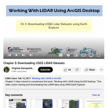 This video, provided by Virginia Geospatial Extension, is part of a series of 16 tutorial videos on using Lidar with ArcGIS Desktop. This tutorial demonstrates how to download Lidar datasets from the United States Geological Survey (USGS) using Earth Explorer. This video runs 03:58 minutes in...
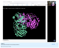 This video, provided by Digital World Biology, is from a series of tutorial videos for iCn3D, a web-based three-dimensional visualization and structural analysis platform for molecular structures. During this video, presenter Sandra Porter offers step-by-step instructions on how to view and analyze...
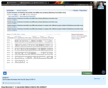
 This video, provided by Digital World Biology, is from a series of tutorial videos for iCn3D, a web-based three-dimensional visualization and structural analysis platform for molecular structures. In this video, presenter Sandra Porter discusses using the protein Basic Local Alignment Search Tool...
 This video, provided by Digital World Biology, is from a series of tutorial videos for iCn3D, a web-based three-dimensional visualization and structural analysis platform for molecular structures. This tutorial builds on the previous video in the series: Drug Discovery 2: Using Protein BLAST For...
|
| ← PreviousNext → |