Identifying Land Use Change in the Santa Clara Valley, California

Learning Unit Description:
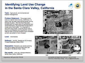
The Integrated Geospatial Education and Technology Training Project (iGETT) presents a series of Learning Units (LU) designed to incorporate federal land remote sensing data into Geographic Information System (GIS) instruction. The Land Use Change Detection in the Santa Clara Valley LU, from Chris Cruz at West Valley College, examines land use in Santa Clara county, California, which is a region that has seen much growth in the last 33 years. Land formerly used as farmland has been transformed into commercial and residential space. This unit asks students to use ArcGIS, Spatial and 3D Analyst, Trimble Pathfinder Office and ENVI software to examine these changes in land use.
The iGETT Learning Units amount to about two weeks of instruction and are designed for use both as “skills-based case studies and building blocks for new courses.” All LUs are intended for students with a basic understanding of GIS. Each LU includes three core documents, an instructor’s guide, a student guide, and a curriculum support document, as well as the remote sensing data needed to complete the unit. Completion of this LU requires at least two hours of lecture time and an additional 4.5 hours of lab time. Students should have a basic knowledge of the MS Office suite, ArcGIS, and ENVI in order to complete the LU.
Upon completion of the lesson, students should be able to display changes in land use, present findings, present options for future land use based on these findings, and present maps and reports that show an understanding of the concepts of land change detection.
For orientation purposes, viewers should begin with Cruz_Thumbnail.pdf, which offers a description of the LU as well as an overview of topics covered, required software, and the intended audience.
Lesson Contents:
The attached files associated with this LU exist in a variety of formats and a variety of geospatial data file types.
Below is a list of the files contained within the .zip attachment. The size of each file is included in parenthesis.
- Documents
- Lesson Overview (Cruz_Thumbnail.pdf 685KB)
- Instructor Guide (Cruz_IG.pdf 169KB)
- Student Handout (Cruz_SH.pdf 137KB)
- Curriculum Support Document (Cruz_CS_June_2008.pdf 13KB)
- Data
- Santa_Clara_County_Data (Santa_Clara_County_Data.rar 72.6MB)
- Santa Clara County Parks_05 (39 data files, 3.6MB)
- Roads
- (schema.ini 42 bytes)
- Planning (45 data files, 1.8MB)
- MapRoads (14 data files, 885KB)
- ParksandOS
- SCCParks (41 data files, 2.5MB)
- Planning (11 data files, 1.3MB)
- MROSD (61 data files, 10.3MB)
- GreenInfo (22 data files, 10.8MB)
- Lakes
- USGS (13 data files, 369KB)
- Scvwd (17 data files, 727KB)
- Planning (12 data files, 346KB)
- GeoHazards
- StateFault (9 data files, 270KB)
- OLD
- Terracheck (20 data files, 962KB)
- SlopeStability (6 data files, 828KB)
- Liquefaction (5 data files, 3.2MB)
- Erisk (6 data files, 25KB)
- DikeFailure (6 data files, 22KB)
- CountyFault (6 data files, 53KB)
- CompressibleSoils (6 data files, 29KB)
- CDMG (36 data files, 860KB)
- County (62 data files, 42.6MB)
- CalGS
- SHZ
- SantaTeresaHills (13 data files, 1.2MB)
- SanJoseWest (15 data files, 83KB)
- SanJoseEast (12 data files, 672KB)
- Planning (23 data files, 9.6MB)
- MountainView (11 data files, 119KB)
- Milpitas (12 data files, 136KB)
- LosGatos (15 data files, 1.9MB)
- Cupertino (15 data files, 1.3MB)
- CalaverasRes (12 data files, 962KB)
- SHZ
- Farmlands (68 data files, 8.5MB)
- CountyOutline (39 data files, 1.1MB)
- Cities
- Planning (30 data files, 15.6MB)
- Milpitas (11 data files, 264KB)
- ISD2004_05 (39 data files, 1.2MB)
- AdminDocs (1 data file, 222KB)
- Santa Clara County_Landsat1 (Santa Clara County_Landsat1.rar 139.7MB)
- MBZ050440340907198400 (MBZ050440340907198400.tar, 13 data files, 619.6MB)
- Santa Clara County_Landsat2 (Santa Clara County_Landsat2.rar 216.5MB)
- NZT070440340420200000 (NZT070440340420200000.tar, 18 data files, 864.9MB)
- Santa Clara County_Landsat3 (Santa Clara County_Landsat3.rar, 155.8MB)
- NZT050440340616200600 (NZT050440340616200600.tar, 13 data files, 646.3MB)
- Santa Clara County_Landsat4 (Santa Clara County_Landsat4.rar 144.1MB)
- NZT050440340620199000 (NZT050440340620199000.tar, 13 data files, 623.9MB)
- Santa_Clara_County_Data (Santa_Clara_County_Data.rar 72.6MB)
About this Resource


Comments